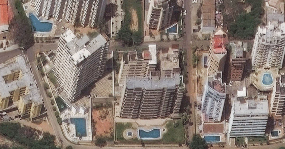
Newly released satellite photography has captured the profound level of destruction across Venezuela, resulting from a pair of devastating earthquakes that struck the nation on Wednesday. The disaster has claimed more than 900 lives, leaving a trail of devastation in its wake.
Occurring just after 6 p.m. on Wednesday, the twin tremors measured 7.2 and 7.5 in magnitude, striking less than one minute apart to the west of the capital, Caracas. These events mark the most powerful seismic activity to hit Venezuela in over a century. The state of La Guaira, located along the northern coast just north of Caracas, experienced the most significant impact.
Images captured by Vantor and Planet Labs PBC clearly illustrate the collapse of buildings and the destruction of major roadways throughout the coastal cities of Macuto, Catia La Mar, and Caraballeda. Amidst the ruins, local authorities are engaged in a critical race against time to recover survivors who may still be trapped beneath the debris of fallen structures.
In the wake of this catastrophe, nations worldwide are mobilizing search-and-rescue teams, with significant assistance pledges already underway. The United Nations is currently coordinating relief efforts on the ground utilizing a global fund. The United States has formally committed $150 million in aid for Venezuela, while Pope Leo has provided an initial donation amounting to 100,000 euros.
Experts note that this geological event, defined by two similar-magnitude earthquakes occurring in the same location and timeframe, is known as a doublet sequence. The ruptures took place along the tectonic boundary separating the Caribbean and South American plates.